
You've probably clocked that Cambridgeshire Walks just loves maps. There's adventure in every map. So where do they come from?
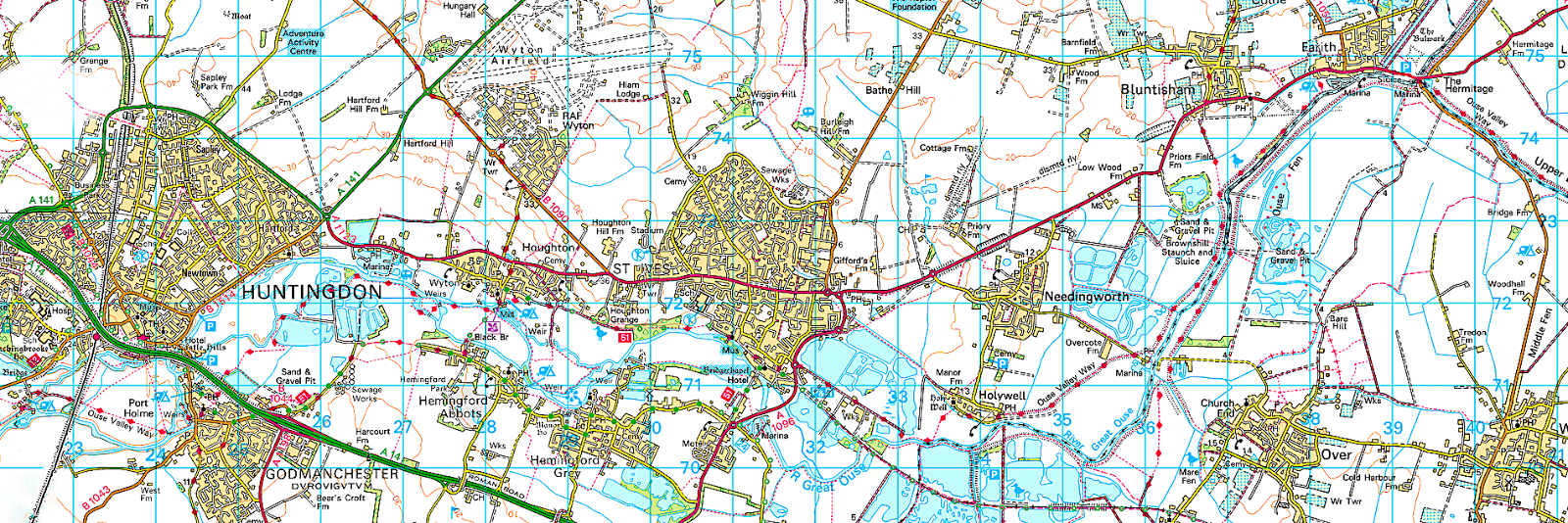
Access free online Ordnance Survey maps at Footpath Maps. When out and about, do you ever spot a footpath sign heading away from the road and wonder where it leads? Check the route to see if it's worth following using this website. Pop your postcode into the search box in the top right hand corner and click go. A map for your area will appear. Drag the map to the location of interest. Search on the location if you know it. 'Select a location' box will appear if there's more than one location with that description. Click the box and select an option.
You can also zoom in and out. Best scales for spotting footpaths (marked as red dash lines) are 1:14k or 1:28k. Once you've identified a route, the closest scales are handy for identifying names of features. Click the key icon to access guides to the map symbols and abbreviations. Generally you can only use the site during mornings. By early afternoon they've often run out of their allocated data.
You can also use My Cambridgeshire to find footpaths within the county. Cambridgeshire County Council are the authority responsible for keeping a record of and maintaining footpaths in Cambridgeshire, and the map shown on the link is their record of footpaths. Select a location to view footpaths marked in purple. Click the arrow in the top left hand corner of the map to remove the side panel and enlarge the view.
Satellite imagery can help in visualising a footpath route and the surrounding countryside. Both Ordnance Survey map and corresponding satellite imagery can be viewed side by side and kept in synch at Where's The Path? Click the binocular icon to search for your location in a similar way to the Footpath Maps website. Although the Ordnance Survey map remains at the same scale when you zoom the satellite image in and out, a box is displayed on the OS map to indicate the satellite area viewed.
Before trekking off, how about viewing what a town or village was like over a hundred years ago? It's quite surprising how even the smallest village has developed in modern times. It's sometimes helpful to identify the original heart of a community. The National Library of Scotland Map Imagery allows you to select Ordnance Survey maps dating from 1841 to 1961 as well as other maps.
The easiest way to find a location is to select a county, then a parish, and finally a map category and series. The default view is 'Find by place', in which case you also have to select a map segment and select a map from the panel that appears on the right. Many locations are split between different map pages, so it's sometimes necessary to change the default at the top to 'Explore georeferenced maps'. This displays pages together as though a single map. You can also change the view to 'Side by side', which shows a satellite view as well as the old map and keeps them in synch as you drag or zoom either.
Aware of any other useful mapping websites? If you are, please leave a comment.
Lots of articles to read at the Walking Blog, or click Return Home at the foot of this page for more walking related options.

No comments:
Post a Comment